

Table of Contents
- Affordable Aerial Property Photography in Kansas City: What to Expect
- Aerial Real Estate Photography Cost: How Pricing Works
- Real Estate Drone Photography Packages: What’s Inside
- Drone Photos for Land Listings: Showing Acreage Clearly
- Aerial Property Photography Tips for Better Results
- Why Vickshots Is a Smart Choice for Aerial Property Photography
- Frequently Asked Questions
Last Updated: October 16, 2026
Affordable Aerial Property Photography in Kansas City: What to Expect
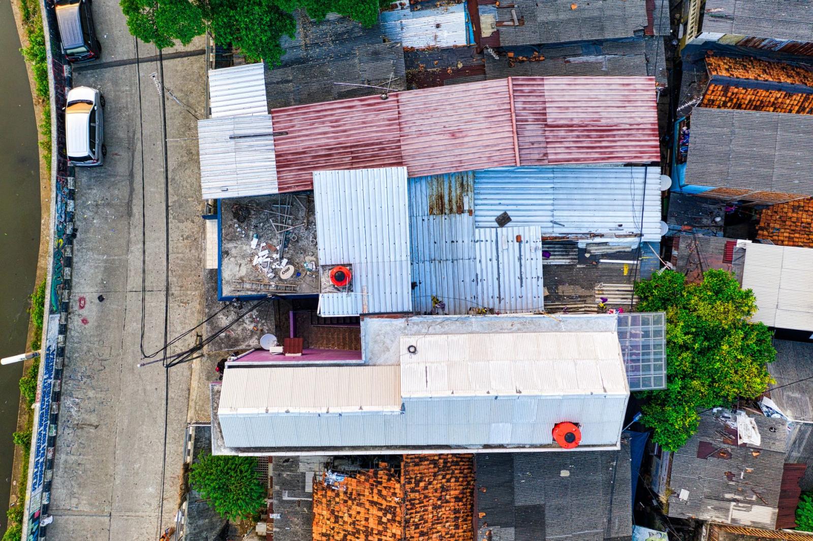
Affordable aerial property photography in Kansas City is photography shot from a drone that shows a home, farm, or commercial lot from above, and it usually costs far less than most owners expect. At Vickshots, we shoot these sessions across the metro, and the biggest surprise for clients is how quickly a drone gets airborne compared to a full ground shoot. Federal Aviation Administration drone rules govern every commercial flight, so a legitimate operator arrives with a licensed pilot, insurance, and a pre-flight check rather than a hobby drone and good intentions.
Aerial property photography is the practice of capturing still images and video of land and buildings from an elevated drone camera to document condition, layout, and surrounding context.
What you get in a typical session:
- A licensed pilot and insured flight
- Coverage of the full parcel, not just the roof
- Edited, web-ready images delivered digitally
- Optional video flyover for listings or documentation
The right approach depends on what you need the images for. A realtor wants curb appeal from above. A homeowner wants to see roof and gutter condition before calling a contractor. A landowner wants to show acreage that a ground camera simply cannot frame. Same drone, three different briefs.
Aerial Real Estate Photography Cost: How Pricing Works
Aerial real estate photography cost depends on flight time, the size of the property, travel distance, and how much editing the final images need. A single residential lot takes far less air time than a 40-acre parcel, and that difference shows up in the quote.
Most providers price one of three ways:
|
Pricing Model |
How It Works |
Best For |
|---|---|---|
|
Flat session fee |
One rate for a set number of images |
Standard homes under an acre |
|
Tiered by acreage |
Rate rises with parcel size |
Farms, land, large lots |
|
Add-on to a ground shoot |
Drone images bundled with standard photos |
Realtors wanting one invoice |
We keep our current rates on the Vickshots pricing page so you can check before you book. If you have ever paid for photos you did not like, ask two questions up front: how many edited images are included, and whether a re-shoot is covered if weather grounds the flight. A provider who answers both clearly is usually the one worth hiring.
Real Estate Drone Photography Packages: What’s Inside
Real estate drone photography packages bundle flight time, image count, and delivery into one price. The package names vary by provider, but the contents usually fall into three tiers.
A basic package covers a single structure and its immediate lot. A mid-tier package adds multiple angles, a short video clip, and neighborhood context shots. A full package includes everything plus a labeled site overview, which matters for commercial lots and new construction.
What to check before you choose a tier:
- Number of edited images, not raw files
- Whether video is included or sold separately
- Turnaround time for delivery
- File format and resolution for print use
- Whether you own the images outright
The gap between tiers is usually flight time, not quality. A smaller package shot well beats a large package rushed through. If a listing only needs four strong exterior angles, pay for four.
Drone Photos for Land Listings: Showing Acreage Clearly
Drone photos for land listings solve a problem ground photography cannot: acreage has no single good vantage point. From the ground, a 60-acre tract looks like a fence line and a field. From the air, the boundaries, tree cover, water, and access roads all read at once. Capturing these expansive perspectives clarifies the true value of professional photography when evaluating how visual assets influence a buyer’s perception of land.
For land, we plan the flight around what a buyer actually needs to see:
- Property lines and corners. Overhead shots that show the full shape of the parcel.
- Access and frontage. Where the road meets the land, and how wide that opening is.
- Terrain and drainage. Slopes, creeks, and low spots that affect building or grazing.
- Existing structures. Barns, sheds, and fences, documented in current condition.
- Neighboring context. What sits next door, which buyers always ask about.
The most common mistake with land is shooting only one altitude. A single high pass shows the whole parcel but hides the details. A single low pass shows detail but loses the boundaries. Good land coverage uses both, plus a few angled shots that give the eye a sense of scale.
Aerial Property Photography Tips for Better Results
Aerial property photography tips matter most in the planning stage. The flight itself is short; the decisions that shape the final images happen before the drone leaves the ground.
Start with a shot list. Tell your photographer what the images are for. A roofing contractor needs close, flat angles of the roof planes. A realtor needs wide, flattering angles that show the home in its setting. A homeowner documenting storm damage needs date-stamped, unedited reference shots.
Other things that improve results:
- Clear the driveway and yard of vehicles, bins, and clutter
- Time the flight for soft light, not harsh midday sun
- Note any no-fly zones or HOA restrictions in advance
- Ask for both wide context shots and tight detail shots
- Request files sized for both web and print
Weather is the one variable nobody controls. Wind above safe limits or low cloud grounds a flight, and a provider who reschedules rather than pushes is protecting your images, not wasting your time. Build a buffer day into any deadline that matters.
Why Vickshots Is a Smart Choice for Aerial Property Photography
Vickshots brings the same relaxed, no-pressure approach to aerial work that we use for family portraits and senior sessions. David Vickers leads every shoot, which means the person who plans your flight is the person flying it. No handoff, no misread brief.
What sets our aerial work apart:
- A licensed pilot and insured flights on every job
- Coverage of the full parcel, from roofline to property line
- Edited images delivered ready for listings, reports, or records
- A calm, unhurried session style, even on a tight timeline
- Service across the entire Kansas City metro area
One client put it plainly: “This David Vickers guy is absolutely spectacular with his eye. The way he catches the moment is like you’re living the dream all over again.” That same eye applies whether we are framing a family on a porch or a farm from 300 feet up.
We also handle commercial events and branding work, so if your business needs aerial site documentation alongside headshots, that can come from one team. Pricing lives on our website, and a free consultation costs nothing but a conversation.
Frequently Asked Questions
How much does aerial property photography cost?
Pricing depends on the package you choose, the size of the property, and how many final images or video clips you need. A basic aerial property photography session may cost less than a full real estate drone photography package that includes multiple angles, edited photos, and a highlight video. Vickshots has a pricing page on its website where you can see current rates and request a custom quote for your property.
What is included in a real estate drone photography package?
Most real estate drone photography packages include a set number of high-resolution aerial photos, editing and color correction, and a licensing agreement for MLS and marketing use. When comparing packages, check the number of final images, turnaround time, and whether the photographer is FAA Part 107 certified. Vickshots offers tailored packages for different property types and budgets.
Do drone photographers need a license for real estate photography?
Yes. In the United States, any drone flight for commercial purposes, including real estate photography, requires a Remote Pilot Certificate under FAA Part 107. This certification ensures the pilot understands airspace rules, safety procedures, and privacy regulations. Always ask to see a photographer’s Part 107 certificate before hiring them. Vickshots is fully certified and insured, so you can book with confidence.
Can drone photography help sell a property?
Aerial photos give buyers a clear view of the property’s layout, lot size, and surroundings that ground-level photos often miss. For land listings or homes with acreage, drone shots can show boundaries, access roads, and nearby amenities in a single image. Listings with professional aerial photography typically attract more clicks and inquiries. Vickshots works with real estate agents and homeowners to create images that highlight what makes each property unique.
Aerial images only pay off when they are shot for a purpose, and that purpose should drive every choice, from altitude to editing. Vickshots handles that planning for you, with licensed, insured flights, full-parcel coverage, and a no-pressure approach that puts the brief first. Get started with Vickshots and book a free consultation to see what your property looks like from above.